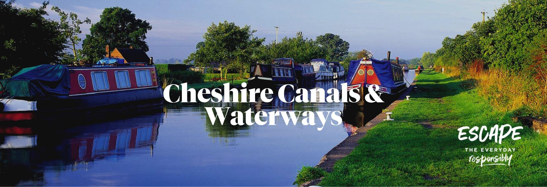
Canals and Waterways are a great way to explore Cheshire at a leisurely pace, as well as offering visitors the opportunity to enjoy sites of historic interest along the way.
Cheshire is home to the Cheshire Ring, consisting of 97 miles of canal and 92 locks, taking 50 hours to complete. The Cheshire Ring is made up three main canals that run through the county; the Macclesfield Canal running through Congleton and Macclesfield, the Trent and Mersey running through Middlewich and Wheelock and then the Bridgewater Canal running through Lymm in the North. The Shropshire Union Canal also skirts Chester's City Walls where you can stop off and explore 2000 years of history.
Why not stop off and explore one of the many towns and villages enroute or take a trip to see Anderton Boat Lift, an incredible edifice, perched on the banks of the River Weaver like some giant three-storey-high iron spider.
The Cheshire Ring is a circuit made up of 6 main sections of canal in the North West of England, three of which run through Cheshire and Warrington; the Macclesfield Canal, the Trent and Mersey Canal and the Bridgewater Canal.
The whole is 97 miles long, with 92 locks and takes 1 week to complete. Hire a narrowboat for a week or for the day and explore the beauty of Cheshire; many attractions, places to eat and visit are accessible from the canal side.
The Cheshire Ring provides a range of canalside scenery from the gentle rolling plains of the Cheshire countryside to the peaks of the Peak District National Park. There is a variety of canal features en-route including locks, aqueducts and tunnels plus the historic town centres of Northwich, Middlewich, Macclesfield and Congleton are within easy reach to explore.
The Wheelock Rail Trail is a popular 2km traffic free route for walkers and cyclists on the outskirts of Sandbach and runs between Ettiley Heath and Malkins Bank.
One of a series of walks from the Nelson Pit Visitor Centre. The route through Poynton Coppice is pretty at any time of the year. The majority of The Coppice is owned by Cheshire East Council and is subject to a ten-year management plan.
Route 73 takes in the Cheshire section of the route from Congleton to Davenham. It provides a link between two National Routes - 55 to the east and 5, which runs through the centre of the county and on to Wales.
The route follows the Macclesfield Canal north and then along wide country tracks before an uphill stretch into Lyme Park. The views from the highest point near Lyme Park on a good day are spectacular.
The route climbs over 1300 feet from Nelson Pit to Bowstones, and is partly strenuous. However, the views from the highest points on a good day are spectacular. This walk should be avoided on a misty day.
Dee River Kayaking is a friendly and professional river kayaking service based in Chester. We offer guided tours and instruction in both Kayak and Stand Up Paddleboard, so however you'd like to get your floating fix, we've got you covered.
A pleasant ramble on the Middlewood Way, across fields and along the towpath of the Macclesfield Canal. Part of the walk, crossing from the Middlewood Way to the Canal can be muddy.
This route, devised by Alsager Chamber of Trade, is one a series of walks in the Alsager area. The walks have been published in leaflets entitled ‘It’s all about Alsager - Walking Maps of Alsager’.
This route, devised by Alsager Chamber of Trade, is one a series of walks in the Alsager area. The walks have been published in leaflets entitled ‘It’s all about Alsager - Walking Maps of Alsager’.
From Congleton you quickly reach tree lined lanes below Congleton Edge. Gritstone rocks nearby give the landscape a very different feel to the Cheshire Plain.
The Bollin Valley Way is a 25 mile (40 km) recreational path shadowing the course of the River Bollin. The route starts at Macclesfield Riverside Park and finishes in Partington giving walkers a feel of the valley's variety.
An energetic short loop climbing onto the ridge leading to Mow Cop. The path leads through beautiful woodlands and there are fabulous views from the ridge. Interesting industrial history – coal mining and Primitive Methodism.
 to add an item to your Itinerary basket.